Travel
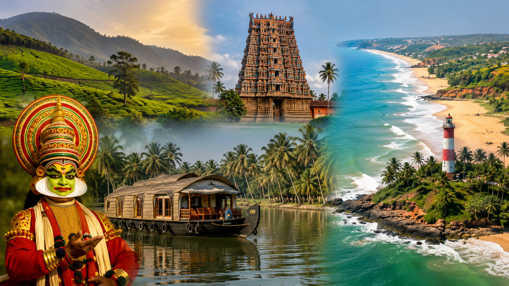
Kerala South: Districts, Culture, and Places to Visit

Kerala South: Districts, Culture, and Places to Visit
Kerala is often described as one region, but anyone who has traveled across the state knows it doesn’t feel that way on the ground. The hill towns of the north look and feel different from the coastal cities near the southern tip, and the food, festivals, and even the local dialect shift as you move across the state. Southern Kerala, in particular, carries its own distinct identity shaped by centuries of history under the former Travancore kingdom.
People searching for “Kerala south” are usually trying to understand which districts fall into this region, what makes it different from central or northern Kerala, and what it actually has to offer, whether that’s for travel planning, general knowledge, or academic reference. This guide lays out the geography, history, culture, and major attractions of South Kerala in a clear, organized way.
Direct Answer
South Kerala, also called the Travancore region, includes the districts of Thiruvananthapuram, Kollam, Pathanamthitta, Alappuzha, and Kottayam, with Idukki sometimes grouped here as well depending on the classification used. The region was historically ruled by the Kingdom of Travancore before Indian independence. It’s known for its backwaters, beaches, hill areas, and temple towns, including Kerala’s capital city, Thiruvananthapuram.
What Defines South Kerala as a Region
Kerala’s 14 districts are commonly grouped into three broad zones based on geography, history, and cultural ties rather than strict administrative rules: North Kerala (the Malabar region), Central Kerala (the Kochi region), and South Kerala (the Travancore region). This grouping isn’t an official government classification, which is why you’ll sometimes see slightly different lists depending on the source. Most groupings place Thiruvananthapuram, Kollam, Pathanamthitta, Alappuzha, and Kottayam firmly in South Kerala, while Idukki is classified as part of the south by some sources and as central by others, since it borders both zones.
What ties these districts together isn’t just geography. Before Kerala became a state in 1956, most of this territory was ruled as the princely state of Travancore, with its capital at Thiruvananthapuram. That shared political history left a lasting mark on the region’s architecture, temple traditions, administrative culture, and local customs, which is why the “South Kerala” label still holds cultural meaning even though it isn’t a formal government unit.
The Districts of South Kerala
Each district in this region has its own character, even though they share a common historical background.
Thiruvananthapuram
Thiruvananthapuram, also known as Trivandrum, is Kerala’s capital and the southernmost district in the state. Built across seven hills, it blends a long seafaring and administrative history with modern government and educational institutions. The Sree Padmanabhaswamy Temple, closely tied to the former Travancore royal family, is one of the district’s most significant landmarks and drew international attention after a major inventory of temple valuables was uncovered inside its vaults. The district is also home to well-known beaches like Kovalam and Varkala, along with museums, botanical gardens, and Ayurvedic wellness centers.
Kollam
Kollam, historically known as Quilon, sits along the coast north of Thiruvananthapuram and has served as a trading port for centuries, with historical links stretching back to early Arabian Sea trade routes. The district is closely associated with Ashtamudi Lake, Kerala’s second-largest lake and a common starting point for backwater cruises. Kollam is also a major center of India’s cashew processing industry, and the nearby Thenmala eco-tourism zone is recognized as one of the country’s first planned eco-tourism destinations.
Pathanamthitta
Pathanamthitta is known for its spiritual significance and natural landscape, formed by three rivers running through hills, midlands, and plains. It’s home to Sabarimala Temple, one of the most visited pilgrimage sites in India, drawing large numbers of devotees during the pilgrimage season. The district is also known for Aranmula, famous for its handcrafted metal mirrors and an annual boat race on the Pampa River, as well as waterfalls like Perunthenaruvi and eco-tourism spots such as Gavi.
Alappuzha
Alappuzha, formerly called Alleppey, is Kerala’s smallest district by area but one of its most recognized internationally because of its backwaters. The Kuttanad region within Alappuzha is known for farming below sea level, protected by dykes, and is often referred to as the rice bowl of Kerala due to its high paddy output. Houseboat cruises through Alappuzha’s canals are among the most popular tourism experiences in the entire state, and the district also has coastal stretches like Alappuzha Beach and Marari Beach.
Kottayam
Kottayam is known for high literacy rates and a strong publishing and print culture, which has earned it recognition as a hub for Malayalam newspapers and printing. Geographically, it offers a mix of backwaters, rubber plantations, and hill terrain. Kumarakom, part of Kottayam district, is one of Kerala’s best-known birding and backwater destinations, drawing visitors for its bird sanctuary and houseboat stays.
Idukki (Sometimes Included)
Idukki is a hill district bordering Tamil Nadu, known for wildlife sanctuaries, tea and spice plantations, and hill stations. Because it sits between the traditionally defined south and central zones, some classifications include it under South Kerala while others place it in Central Kerala. Either way, it’s closely connected to the region through trade, transport, and tourism circuits.
Historical Background: The Travancore Kingdom
Understanding South Kerala means understanding Travancore, the princely state that governed most of this territory before Indian independence. Travancore was ruled by a line of monarchs from Thiruvananthapuram and was known for relatively progressive social reforms in areas like education and public health compared to many other princely states of the time.
After independence, Travancore merged with the neighboring state of Cochin in 1949 to form Travancore-Cochin. This state was later reorganized in 1956 under the States Reorganisation Act, which combined Travancore-Cochin with Malabar (the northern region that had been under Madras Presidency) to create the modern state of Kerala. That merger is why Kerala today includes three culturally distinct zones, Malabar, Kochi, and Travancore, under one state government.
This history explains a lot about South Kerala’s character. Temple architecture, administrative traditions, and even certain culinary styles in this region reflect Travancore-era influence, distinguishing it somewhat from the Malabar customs found further north.
Geography and Natural Features
South Kerala sits between the Arabian Sea to the west and the Western Ghats to the east, giving it a mix of coastal plains, midland hills, and highland terrain within a relatively short distance. This geographic range is part of why the region supports such varied activities, from beach tourism to backwater cruises to hill trekking.
The backwaters are arguably the most defining natural feature of the region. Formed by a network of lakes, canals, rivers, and inlets running roughly parallel to the coast, they’re used for transportation, fishing, and farming, in addition to tourism. Alappuzha and Kollam are the two districts most closely tied to Kerala’s backwater tourism industry, though smaller backwater stretches exist throughout the southern coastline.
Rivers originating in the Western Ghats, including the Pampa River, feed into this backwater system and support agriculture in low-lying areas like Kuttanad, where rice is cultivated on land that sits below the surrounding water level.
Culture and Everyday Life
Malayalam is the primary language spoken throughout South Kerala, as it is across the entire state, though regional accents and vocabulary do shift slightly compared to central and northern Kerala. Hinduism, Christianity, and Islam are all well established in the region, and this diversity shows up clearly in the mix of temples, churches, and mosques found across southern districts.
Festivals play a major role in community life. Onam, Kerala’s harvest festival, is celebrated widely across the region with boat races, floral decorations, and traditional feasts. Pathanamthitta’s Aranmula boat race and Kollam’s temple festivals are examples of how local traditions blend religious observance with community celebration.
Food in South Kerala reflects its coastal and agricultural geography, with rice, coconut, and seafood forming the base of many traditional meals. Cashew, grown extensively around Kollam, is both a local food ingredient and a significant export product for the district.
Economy of South Kerala
The region’s economy draws on a mix of agriculture, small-scale industry, tourism, and services.
Agriculture remains significant, particularly rice cultivation in Alappuzha’s Kuttanad region and rubber cultivation in parts of Kottayam.
Industry is anchored by Kollam’s cashew processing sector, which has historically been one of the largest employers in the district and a major contributor to India’s cashew exports.
Tourism is a major economic driver across nearly all southern districts, supported by backwater cruises, beach destinations, pilgrimage tourism at sites like Sabarimala, and wellness tourism centered on Ayurveda in Thiruvananthapuram.
Public administration and education are concentrated in Thiruvananthapuram as the state capital, home to government offices, universities, and research institutions.
Why South Kerala Matters for Travelers
For visitors, South Kerala offers a fairly complete cross-section of what draws people to the state overall: beaches, backwaters, temples, hill areas, and cultural heritage sites, all within a compact and well-connected area.
Thiruvananthapuram works well as an entry point, given its airport, colonial-era architecture, and proximity to Kovalam and Varkala beaches. From there, many travelers move north through Kollam for backwater cruises starting at Ashtamudi Lake, then continue to Alappuzha for houseboat stays through Kuttanad’s canals. Pathanamthitta and Kottayam appeal more to travelers interested in pilgrimage sites, eco-tourism, or quieter countryside experiences away from the main coastal circuit.
Because the districts are relatively close together, it’s common for travel itineraries to combine two or three southern districts in a single trip rather than focusing on just one.
Common Mistakes and Misconceptions
Assuming “South Kerala” is an official government classification. It’s a widely used cultural and geographic grouping, not a formal administrative division. Kerala’s actual administrative structure is based on its 14 individual districts.
Confusing South Kerala with South India generally. South Kerala refers specifically to the southern part of the state of Kerala, not the broader South Indian region, which includes other states like Tamil Nadu, Karnataka, Andhra Pradesh, and Telangana.
Assuming every source lists the same districts. Because the regional grouping is informal, Idukki’s placement varies between sources. This isn’t an error on anyone’s part; it simply reflects that the boundary between central and southern Kerala isn’t fixed.
Overlooking the inland districts in favor of coastal ones. Alappuzha and Thiruvananthapuram tend to dominate South Kerala’s tourism reputation, but Pathanamthitta and Kottayam offer significant cultural and natural attractions that are easy to miss if travel planning focuses only on the coast.
Real-World Examples
A backwater trip through Alappuzha and Kollam: Many visitors begin a houseboat cruise at Ashtamudi Lake in Kollam and travel south through connecting canals toward Alappuzha, passing through Kuttanad’s rice paddies and small riverside villages along the way.
A pilgrimage journey to Sabarimala: Devotees traveling to Sabarimala Temple in Pathanamthitta often combine the trip with visits to nearby sites like Aranmula, known for its metal mirror craftsmanship and river boat races.
A short coastal getaway from Thiruvananthapuram: Travelers based in the capital frequently take short trips to Kovalam or Varkala for beach time, combining it with a visit to Sree Padmanabhaswamy Temple or one of the city’s museums.
Birdwatching at Kumarakom: Visitors interested in wildlife often base themselves in Kottayam district specifically to visit Kumarakom Bird Sanctuary, combining it with a backwater houseboat stay in the same area.
Key Facts
- South Kerala is commonly defined as Thiruvananthapuram, Kollam, Pathanamthitta, Alappuzha, and Kottayam, with Idukki sometimes included depending on the source.
- The region was historically part of the Travancore kingdom before merging into Travancore-Cochin in 1949 and later into the state of Kerala in 1956.
- Thiruvananthapuram is both the capital of Kerala and the southernmost district in the state.
- Alappuzha is Kerala’s smallest district by area but one of its most visited due to its backwaters.
- Kollam is a major center for India’s cashew processing industry.
- Sabarimala Temple, located in Pathanamthitta, is one of the most visited pilgrimage sites in India.
- Kumarakom, in Kottayam district, is known for its bird sanctuary and backwater tourism.
FAQ
Q1: What districts make up South Kerala?
Ans: South Kerala typically includes Thiruvananthapuram, Kollam, Pathanamthitta, Alappuzha, and Kottayam. Idukki is sometimes included as well, depending on the classification used, since it borders both the southern and central regions.
Q2: Why is South Kerala also called Travancore?
Ans:Before Indian independence, most of this territory was governed by the Kingdom of Travancore, ruled from Thiruvananthapuram. The historical name is still used informally to describe the region today.
Q3: Is South Kerala the same as South India?
Ans: No. South Kerala refers only to the southern districts within the state of Kerala. South India is a much larger region that includes several separate states.
Q4: What is South Kerala best known for?
Ans: It’s best known for its backwaters, particularly in Alappuzha and Kollam, along with beaches near Thiruvananthapuram, pilgrimage sites like Sabarimala in Pathanamthitta, and birding destinations like Kumarakom in Kottayam.
Q5: Is South Kerala good for tourism?
Ans: Yes, the region offers a wide mix of attractions, including beaches, backwaters, temples, and hill areas, all within a relatively compact and well-connected travel circuit.
Q6: What language is spoken in South Kerala?
Ans: Malayalam is the primary language across the entire region, as it is throughout Kerala, though local vocabulary and accents can vary slightly by district.
Key Takeaways
- South Kerala is a cultural and geographic grouping, not an official administrative division, generally including Thiruvananthapuram, Kollam, Pathanamthitta, Alappuzha, and Kottayam.
- The region’s identity is rooted in its history as the former Kingdom of Travancore.
- Thiruvananthapuram serves as both the state capital and the region’s administrative and cultural center.
- The region is known for backwaters, beaches, pilgrimage sites, and eco-tourism destinations spread across its districts.
- Idukki’s inclusion in South Kerala varies by source, since it sits on the border between the southern and central zones.
Conclusion
South Kerala brings together a distinct set of districts shaped by shared history, geography, and culture rooted in the former Travancore kingdom. From the capital city of Thiruvananthapuram to the backwaters of Alappuzha and Kollam, the temple town of Pathanamthitta, and the birding hub of Kumarakom in Kottayam, the region offers a wide range of landscapes and experiences within a relatively small area. Understanding how these districts fit together, historically and geographically, makes it easier to see why South Kerala continues to hold its own distinct identity within the broader state.

667 Area Code: Complete Guide to Location, Cities, and Coverage
If a call or text just showed up on your phone from a 667 number and you don’t recognize it, you’re probably wondering two things: where is this call actually coming from, and is it safe to answer? You’re not alone. The 667 area code is relatively new compared to most others in the country, which means a lot of people still aren’t familiar with it, even though it now shows up constantly on caller ID across one of the busiest phone regions on the East Coast.
This guide covers everything you need to know about the 667 area code — where it’s located, which cities and counties it serves, why it exists alongside two other area codes in the same region, and what to do if you get a suspicious call from a 667 number.
Direct Answer: Where Is the 667 Area Code?
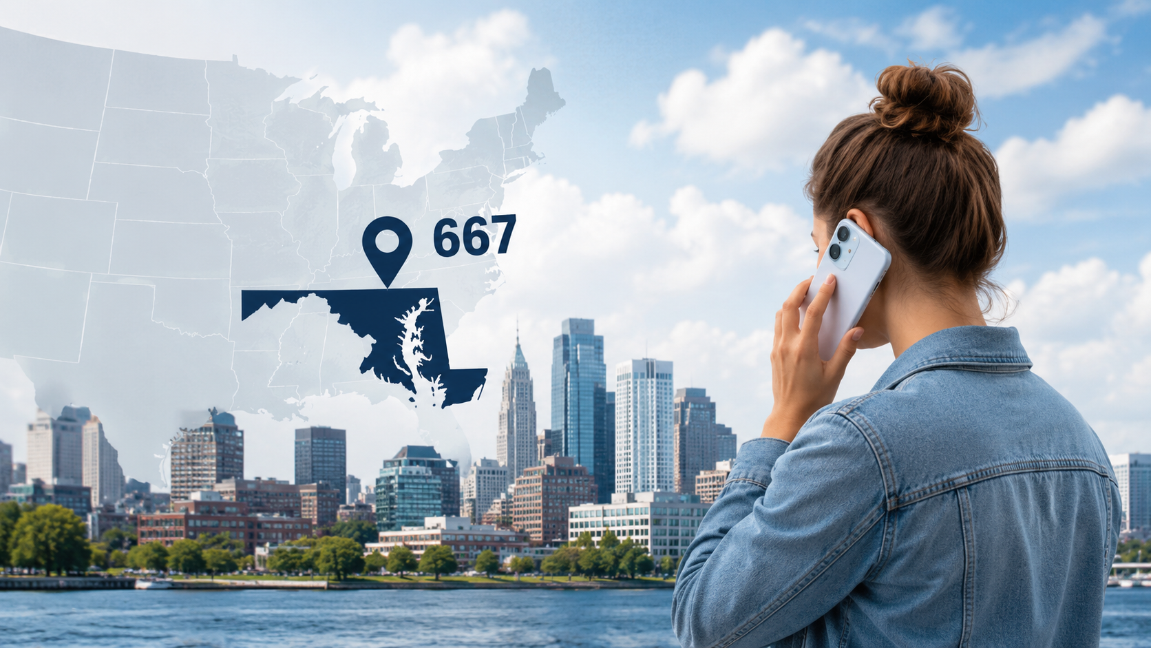
The 667 area code serves Maryland, covering the Baltimore metropolitan area and surrounding counties, including Baltimore City, Baltimore County, Anne Arundel County, and Howard County. It went into service on March 24, 2012, as an overlay area code, meaning it shares the exact same geographic territory as Maryland’s existing 410 and 443 area codes rather than replacing either one.
What Is an Overlay Area Code?
To understand 667, it helps to understand what an overlay area code actually is. Before 1992, every area code covered its own distinct geographic territory. When a region ran low on available phone numbers, the solution was to split that territory in two and assign a new area code to one half.
Overlays work differently. Instead of splitting the region, phone regulators add a brand-new area code that covers the exact same geography as the existing one. Both area codes then operate side by side, and new phone numbers get assigned to whichever code still has availability. This is exactly what happened in Maryland: 667 was layered on top of the 410 and 443 area codes rather than carving out new territory.
This is also why two neighbors, or even two people in the same household, can have phone numbers with completely different area codes despite living at the same address. It’s not a mistake. It’s simply how their numbers happened to be assigned when they signed up for service.
Cities and Counties Covered by Area Code 667
Because 667 is an overlay for 410 and 443, it covers the same wide stretch of central and eastern Maryland that those two codes already serve. This includes Baltimore, the state’s largest city, along with a long list of surrounding suburbs and satellite towns.
Major cities served include:
- Baltimore
- Columbia
- Towson
- Dundalk
- Glen Burnie
- Ellicott City
- Annapolis
- Pikesville
- Essex
- Parkville
Counties covered include:
- Baltimore City
- Baltimore County
- Anne Arundel County
- Howard County
- Harford County
Altogether, the combined 410/443/667 overlay region serves a population of more than 4 million people, making it one of the larger telephone numbering regions on the East Coast. That population figure reflects everyone in the overlay zone, not just people specifically assigned a 667 number, since all three codes serve the same customers interchangeably.
Why Was the 667 Area Code Created?
Area codes run out of available number combinations the same way a parking lot runs out of spaces. Every phone number is a unique combination of digits, and once a region’s population and business activity grow large enough, the supply eventually gets exhausted.
Maryland’s 410 area code was introduced in 1991, splitting off from the older 301 code to serve the Baltimore region on its own. As mobile phones, fax lines, and business numbers multiplied through the 1990s and 2000s, 410 numbers began running low. Maryland responded first with 443, an overlay introduced in 1997, and later added 667 in 2012 once 443 also began approaching capacity.
Regulators chose the overlay approach specifically because it avoids forcing longtime residents and businesses to change existing phone numbers. A geographic split would have required everyone in half the region to get a new area code, which creates real headaches for businesses with printed materials, established phone numbers, and long-standing customer relationships. An overlay avoids all of that disruption.
How Ten-Digit Dialing Works With 667
One practical side effect of overlay area codes is that you can no longer dial just seven digits for a local call, even if you’re calling someone in the same neighborhood. Since three different area codes serve the same region, the phone system needs the full area code every time to know exactly which number you mean.
Here’s what that looks like in practice:
- Dial 1, followed by the area code, followed by the seven-digit number, for any call within the 410/443/667 region.
- Include the area code even if you and the person you’re calling both have Baltimore-area numbers.
- For calls from outside the United States, use the country exit code, then +1, then the ten-digit number.
This ten-digit dialing requirement applies throughout the overlay zone and isn’t unique to Maryland. Most regions with overlay area codes across the U.S. require the same thing.
Is a 667 Number a Cell Phone or a Landline?
A 667 area code alone doesn’t tell you whether a number belongs to a cell phone or a landline. Area codes are assigned based on geographic region, not phone type. Within the 667 code, roughly two-thirds of assigned numbers go to landlines and about a third go to wireless numbers, though that mix shifts constantly as more people rely on mobile service instead of home phone lines.
If you need to know whether a specific 667 number is a cell phone or landline, a reverse phone lookup service can usually tell you, since carriers register that information when a number is issued.
Common Mistakes and Misconceptions About the 667 Area Code
Misconception: 667 is a new, separate calling region from 410 and 443. This isn’t accurate. All three codes serve the exact same geographic area. A 667 number is just as local to Baltimore as a 410 or 443 number.
Misconception: You can tell where in Maryland someone lives based on whether their number starts with 667. Because 667 covers such a wide overlay region, from Baltimore City out to Anne Arundel and Howard counties, the area code alone doesn’t pinpoint a caller’s specific town.
Misconception: A call from a 667 number is guaranteed to be from Maryland. Scammers frequently use caller ID spoofing to make calls appear to come from a local area code, even when the call originates somewhere else entirely, sometimes outside the country. Seeing 667 on your caller ID doesn’t confirm the caller is actually in Maryland.
Real-World Example: Spotting a Spoofed 667 Call
Imagine you get a call from a 667 number, and the caller identifies himself as a government representative saying there’s a problem with your Social Security number and you need to act immediately or face arrest. That combination — urgency, a threat, and a request for personal information — is a defining pattern of phone scams, not a legitimate call. Real government agencies like the Social Security Administration generally reach out through official mail first and never threaten immediate arrest over the phone. If a 667 call follows this pattern, the safest move is to hang up and independently verify the situation by calling the agency directly using a number you look up yourself.
How to Handle Suspicious 667 Calls
- Don’t call back numbers that rang once and hung up. This “one-ring” tactic is designed to make you call back a premium or scam number out of curiosity.
- Avoid confirming personal information to an unsolicited caller, even if they already seem to know some details about you.
- Use your phone’s built-in call-blocking or spam-labeling features, which are increasingly effective at flagging known scam numbers.
- Report scam calls to the Federal Trade Commission, and report anything involving impersonation of the IRS to the Treasury Inspector General for Tax Administration.
- If a call claims to be from Medicare or the Social Security Administration, remember that both agencies primarily contact people by mail and will not threaten arrest over the phone.
Key Facts About the 667 Area Code
- Located in Maryland, covering the Baltimore metropolitan region
- Went into service on March 24, 2012
- An overlay area code, sharing territory with 410 and 443
- Serves Baltimore City along with Baltimore, Anne Arundel, Howard, and Harford counties
- Falls entirely within the Eastern Time Zone
- Requires ten-digit dialing for all local calls, since three area codes share the region
- Combined 410/443/667 overlay region serves a population of more than 4 million people
Frequently Asked Questions
Q1: What state is the 667 area code in?
Ans: The 667 area code is in Maryland, covering Baltimore and the surrounding metropolitan region.
Q2:Is 667 a real U.S. area code?
Ans: Yes. It’s a legitimate area code assigned by the North American Numbering Plan Administrator and has been active since 2012.
Q3:Why do I have to dial the area code for local calls in the 667 region?
Ans: Because 667 is an overlay that shares its territory with 410 and 443, the phone system requires all ten digits, including the area code, to route calls correctly, even for local numbers.
Q4:Are all 667 calls scams?
Ans: No. The vast majority of 667 numbers belong to real residents and businesses in the Baltimore area. Some scam calls use spoofed 667 numbers to appear local, but that doesn’t mean every call from this area code is fraudulent.
Q5:Can I get a 667 phone number if I don’t live in Maryland?
Ans: Yes. Many phone and business communication providers let you choose a virtual number with a specific area code, including 667, regardless of where you physically live.
Q6:How is 667 different from 410 and 443?
Ans: There’s no functional difference. All three area codes cover the exact same geographic territory in Maryland and are used interchangeably for new phone numbers.
Key Takeaways
- The 667 area code covers the Baltimore, Maryland metropolitan area.
- It’s an overlay area code that shares territory with 410 and 443 rather than serving a separate region.
- It became active in 2012 as Maryland’s numbering capacity in 410 and 443 ran low.
- Ten-digit dialing is required for all calls within the overlay region.
- A 667 caller ID doesn’t guarantee the call is actually coming from Maryland, since scammers can spoof local area codes.
Conclusion
The 667 area code is simply one of three area codes that all point to the same part of Maryland, centered on Baltimore and its surrounding suburbs. Understanding how overlay area codes work explains why you might see three different codes attached to numbers from people who all live in the same city. As with any area code, a little caution goes a long way. Recognizing common scam patterns, like urgent threats or unexpected requests for personal information, matters far more than the area code itself when deciding whether a call is safe to answer.
-

 News2 months ago
Did Bruce Willis Pass Away? The Truth Explained
-

 News4 months ago
Who Is Julissa Thaler? The Case of Eli Hart and a Broken Child Welfare System
-

 Technology2 months ago
Christopher Knight’s Tribute to Jennifer Runyon Explained
-
 Food3 months ago
What Is VMC Paloma? Everything You Need to Know
-

 Heath2 months ago
How to Prevent Freezer Burn: A Complete Guide
-

 News3 months ago
Alexander Brothers: Case Timeline and Key Facts
-

 Sports3 months ago
Red Sox vs Reds: History, 2026 Matchups, and What Makes This Rivalry Worth Watching
-
 News3 months ago
Cheapest States to Live In: 2026 Rankings and Guide